Main
The HYSOMA (Hyperspectral SOil MApper) is a software interface currently developed at the GFZ German Research Center for Geosciences. It is an experimental platform for soil mapping applications of hyperspectral imagery that allows easy implementation in the hyperspectral and non-hyperspectral communities (distribution under the idl-virtual machine) and gives the choice of multiple algorithms for each soil parameter. The main motivation for HYSOMA development is to provide experts and non-expert users with a suite of tools that can be used for soil applications. The algorithms focus on the fully automatic generation of semi-quantitative soil maps for key soil parameters such as soil moisture, soil organic carbon, and soil minerals (iron oxides, clay minerals, carbonates). Additional soil analyses tools were implemented to allow e.g. the derivation of quantitative maps based on in-situ data sets.
Background:
HYSOMA was developed in the frame of the EU-FP7 EUFAR (European Facility for Airborne Research) /JRA2-HYQUAPRO project and the EnMap (Environmental Monitoring and Analysis Program) hyperspectral satellite science program. Higher performing soil algorithms were in development as demonstrators for end-to-end processing chains with harmonized quality measures. For this, a review of existing soil algorithms and methodologies based on soil spectroscopy currently successful for the identification and prediction of soil properties was performed. Based on this review and following experts suggestions from the 1st and 2d EUFAR Expert Working Group Workshop on hyperspectral soil applications held at GFZ Potsdam, Germany, on 15-16 April 2010 and 29-31 Agust 2011, the strategy to develop the HYSOMA was focused on the following objectives:
- To provide fully automatic generation of semi-quantitative soil maps that do not need input from spectral libraries or ground truth data
- To focus on five key soil parameters: soil moisture, soil organic matter, iron oxide, clay content, carbonate content
- To use soil functions based on analytical and empirical algorithms
- To offer the choice of multiple algorithms for each soil parameter
- To provide additional user custom option for fully quantitative mapping
HYSOMA distribution & future developments:
The HYSOMA is a stand-alone IDL software interface and distributed for free under the idl-virtual machine upon the acceptance of our license. An automatic version of HYSOMA running without interface has been in the frame of EUFAR implemented in the DLR hyperspectral processing chain. The interactive version of HYSOMA including the graphical user interface is being (soon!) implemented in the EUFAR Toolbox and a version of HYSOMA adapted for satellite applications of soil spectral imagery will be implemented in the EnMap Toolbox in 2012.
We are constantly working on HYSOMA and hope to add more soil functions in the future. We would be happy to receive also your sugestions, comments on our software, and how you think we could do it better.
If you just want to use HYSOMA to get results, it would be nice to acknowledge us in your publications through the following reference (download here):
Chabrillat, S., Eisele, A., Guillaso, S., Rogaß, C., Ben-Dor, E. and Kaufmann, H. (2011), HYSOMA: An easy-to-use software interface for soil mapping applications of hyperspectral imagery, Proceedings of the 7th EARSeL SIG Imaging Spectroscopy Workshop, Edinburgh, Scotland, UK, 11-13 April 2011.
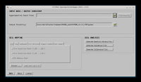
Screenshots:
